Tag: Hurricane Erin

  • Spirit Airlines Flight Path Through Hurricane Erin

    Social media was buzzing with concern and questions after flight tracking data from FlightRadar24 showed a Spirit Airlines flight, NK2298, appearing to fly directly through Hurricane Erin on August 18, 2025. The flight, traveling from Philadelphia to San Juan, Puerto Rico, became a hot topic when the flight tracker shared its path with a caption referencing specialized storm-flying missions.

    Navigating the Storm: Expert Context

    As the Category 4 hurricane churned in the Caribbean, the Airbus A320 landed in San Juan about 40 minutes behind schedule. While many travelers expressed alarm at the seemingly dangerous flight path, aviation experts stepped in to provide context. They explained that at a cruising altitude of 37,000 feet, the actual conditions encountered by the aircraft might have been significantly different from what the tracking data suggested.

    Spirit Airlines quickly addressed the viral post, assuring the public that all safety protocols were strictly followed. Representatives stated, “Our pilots followed procedures and Air Traffic Control instructions while en route to San Juan.” The airline also highlighted its robust weather monitoring systems, noting that its Operations Control Center works closely with pilots and Air Traffic Control to determine safe flight paths that navigate around or above adverse weather.

    Public Reaction and Hurricane Details

    Despite the airline’s assurances, the incident prompted varied reactions online. Some users criticized the routing decision as “dumb,” while others made light of the situation, referencing Spirit Airlines’ reputation for budget travel. According to NOAA, Hurricane Erin had regained Category 4 strength the night before the flight on August 17. In the days following the incident, the storm weakened to a Category 2 as it moved northward, and by August 22, it was in the early stages of transitioning to a post-tropical storm.

    What are your thoughts on flying through or near severe weather? Share your experiences and opinions in the comments below!

  • Hurricane Erin Causes Chaos Along East Coast

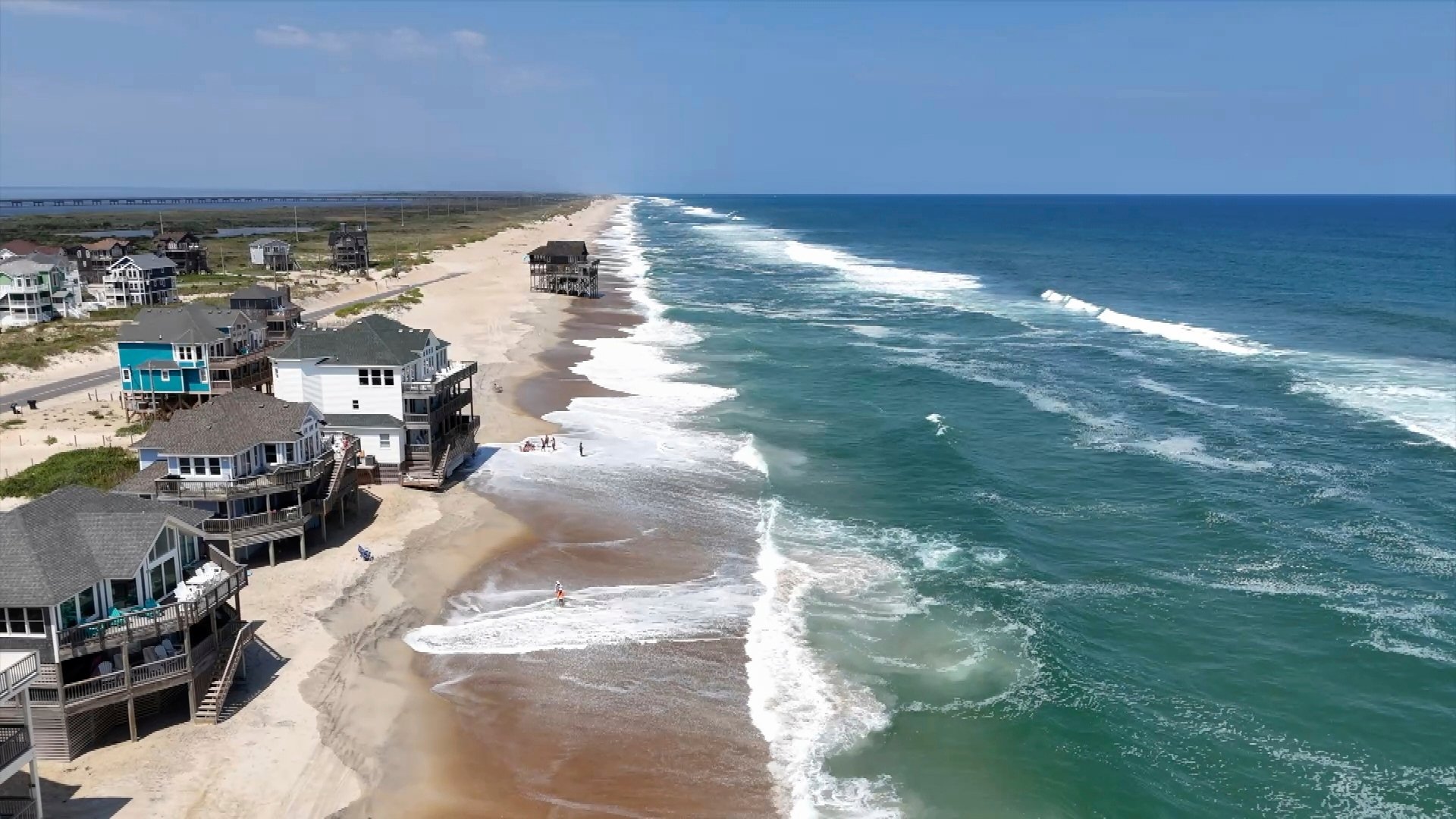
    Even though Hurricane Erin isn’t making a direct landfall, its immense power is already causing significant disruptions along the entire East Coast. From Florida all the way up to New England, the storm is generating dangerous conditions, prompting evacuations and widespread alerts.

    A Dangerous Storm’s Reach

    Having rapidly intensified from a tropical storm to a Category 5 hurricane over the weekend before settling back to a Category 4, Erin’s sheer size is a major concern. Its outer bands have already brought heavy rain to Puerto Rico, leaving approximately 100,000 residents without power, according to Governor Jenniffer González-Colón. The Turks and Caicos Islands and parts of the Bahamas are also under tropical storm warnings, with the potential for flash flooding and mudslides.

    The National Weather Service in Morehead City, North Carolina, issued a stark warning: “This is not the week to swim in the ocean.” Dare County Emergency Management in North Carolina declared a mandatory evacuation for Hatteras Island, citing the life-threatening risks from surf and flooding. Officials are emphasizing that even though Erin is expected to stay offshore, the threat of rip currents and high surf along the beaches is very real.

    Coastal Impacts and Warnings

    Forecasters are predicting waves as high as 20 feet, which will likely lead to extensive beach erosion, particularly along the Outer Banks. Officials have warned that sections of N.C. Highway 12 on Hatteras Island may be impassable for several days due to the severe weather. With August still bringing heavy beach crowds, authorities are strongly urging everyone to heed the rip current alerts and stay informed about the storm’s progression throughout the week.

    Have you been affected by Hurricane Erin’s conditions? Share your experience in the comments below!

  • Hurricane Erin Forces Outer Banks Evacuations

    Hurricane Erin is making its presence felt along the North Carolina coast, prompting evacuations on the Outer Banks. While the storm is expected to track offshore, authorities are warning of significant threats, including dangerous rip currents and potential coastal flooding, even as the peak of tourist season continues.

    Preparing for the Storm

    Holly Andrzejewski, who recently purchased the historic Atlantic Inn on Hatteras Island, had to reschedule her first guests due to the approaching storm. She and her husband took measures to secure their property, ensuring their innkeepers had generators, extra water, and flashlights. “It’s just one of those things where you know this is always a possibility and it could happen, and you just make the best out of it,” Andrzejewski commented, reflecting the resilient spirit of beach communities.

    The storm, though expected to curve north and away from the East Coast, has led to tropical storm and surge watches for much of the Outer Banks. Officials in Wrightsville Beach reported rescuing at least 60 swimmers from rip currents on Monday alone, highlighting the immediate dangers posed by the storm’s outer bands.

    Evacuations and Vulnerabilities

    Evacuations have been ordered for barrier islands like Hatteras Island and Ocracoke. This comes during the busy tourist season for these low-lying islands, which are increasingly susceptible to storm surges. Concerns are high that several days of heavy surf, strong winds, and waves could damage or even wash out sections of the main highway, potentially leaving some routes impassable for days.

    For Ocracoke, this is the first evacuation since Hurricane Dorian in 2019, which caused unprecedented damage. Tommy Hutcherson, owner of the island’s only grocery store, expressed cautious optimism, recalling the impact of Dorian and hoping Erin won’t be as severe, though acknowledging the unpredictability of such storms.

    Climate Change and Hurricane Intensity

    Scientists are increasingly linking the rapid intensification of Atlantic hurricanes to climate change. Factors like warmer ocean temperatures and increased atmospheric water vapor provide hurricanes with more fuel, allowing them to strengthen more quickly and unleash heavier rainfall. Bermuda is expected to face the most severe threat by Thursday evening, with potential swells reaching up to 24 feet.

    Have you ever experienced a hurricane or severe weather event? Share your preparedness tips and experiences in the comments below!